Description
Schadow1 Expeditions Offline GPS Map of the Philippines is a navigation map of the country built for Garmin devices. It can also be used as a map for Basecamp and Roadtrip for Mac.The map data includes Schadow1 Expeditions mapping contributions obtained from its mapping expeditions of the country over the past decade. Over 2.5 million map data has been contributed by Schadow1 Expeditions from over 30 mapping expeditions.
To date, the Schadow1 Expeditions Offline GPS Map of the Philippines has the most number of mapping data than any other online and offline maps available and is freely accessible.
Special Features:
- Optimized and improved rendering speed in spite of the number of data it has
- Routing-capable
- Water-transport routes
- City and Municipal Boundaries
- Business hours of establishments
- Contact numbers of establishments
- Indicator of 24/7 operations
- Switchable between navigation and emergency response mode.
- Frequently updated
- Improved visibility of established hiking trails.
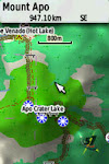
- Hillshaded and 3D Routing capabilities (Based on latest Digital Elevation Model v2020)
- Elevation Contour Map available as an optional layer
- Speed limit warning as an optional add-on
- Includes over: (as of 2018-11-14)
- 75 Hiking trails
- 630 Bicycle routes
- 93,731 points of interests
- 47,888 beaches
- 257,775 kilometers of roads
- 19,727 gasoline stations
- 1,494 evacuation centers
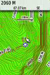
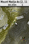
Elevation Contour Map of the Philippines
The Schadow1 Expeditions Elevation Contour Map of the Philippines is an offline topographical map of the Philippines that can be used in tandem with the Navigation Map to provide elevation data.Special Features:
- Based on most detailed NASADEM released February 2020 at 1 arc-second (30-meter) accuracy, void-filled using latest technology and algorithm at 10-meter intervals.
- Visually-optimized on day and night modes.
- Add-on for the GPS navigation map to assist off-roaders, hikers, and rescue responders on their path.
Speed Limits Alerts for the Philippines
Available as an add-on to warn drivers when exceeding the speed limit in Philippine expressways.Usage Rights
The map style is licensed under CC-BY-NC-SA 4.0. Available for non-commercial use and distribution under the same conditions.The elevation contour map is licensed under CC-BY-NC-ND 4.0. Available for non-commercial use. derivatives are prohibited.
Usage of images and contents available explained further on our license page.
Source code for versions, map style, and generation is available on OSMPHGPS and 10mElevPH on Github.
The Schadow1 Expeditions Offline GPS Map of the Philippines is not supported nor connected with the hardware manufacturer, Garmin Ltd. and is not responsible for any damage that may occur on its hardware components and firmware.
Screenshots
Downloads
Latest Versions:
- Free Routable Map: v1.24 (see the comparison from v1.24 to latest version)
- Free Demo Map: v3.21
- Speed Limits Alerts: v1.3
- Routable Map: v3.21
- Humanitarian Activation Map: v3.21
- 3D Terrain Routable Map: v5.05
- 20-m step Elevation Contour: v4.0
- 10-m step Elevation Contour: v4.0
Product Comparison
 |
| Click to zoom-in |
Donation Versions
Routable GPS Navigation 3D Terrain Map of the Philippines v5.05
Regular Updates. Latest improvements
GPS navigation map for slope routing (routing with elevation data), off-road, mountain biking, hiking. Compatible with both Garmin™ 3D Terrain and/or Hillshading. Can work together with the optional add-on Elevation Contour Map for elevation information on display.
DONATE Php 2650/month
Map data based on the latest OpenStreetMap extract and terrain data processed from elevation models by NASADEM Global 1-arc second elevation data (void-filled, 2020).
Routable GPS Navigation Map of the Philippines v3.21
Weekly Updates. Latest Improvements
Optimized for Cars and Motorcycles with the latest improvements.
Optionally add Elevation map for Off-road, mountain biking, hiking.
DONATE Php 550/month
Map data is based on the latest OpenStreetMap extract.
Add-on for routable GPS Navigation Map to include elevation data on display for precision off-road, mountain biking, hiking.
DONATE Php 2650
Data based on elevation models by NASADEM Global 1-arc second elevation data (void-filled, 2020).
Free Versions
Routable GPS Navigation Map of the Philippines v1.24
Free Updates
Optimized for Cars and Motorcycles.
Optionally add Elevation map for Off-road, mountain biking, hiking.
Fill up the request form
Please do not link directly to the files.
Compile Version History

Humanitarian Activation Map v3.21
Optimized for rescue/relief operations with buildings, blockages (dependent on recently mapped data) and evacuation centers.
Registration Required (free for emergency responders)
Fill up the request form
Registration Required (free for emergency responders)
Add-on for routable GPS navigation map for elevation data on display suitable for off-road, mountain biking, hiking.
Fill up the request form
Data based on elevation models by NASADEM Global 1-arc second elevation data (void-filled, 2020).
Speed Limit Alerts v1.3
Be notified when you are exceeding the speed limits on your GPSr device while driving.
Free
Fill up a request form
Archive password is our URL - www.s1expeditions.com
Demo Versions
GPS Navigation Map of the Philippines v3.21 Demo
Optimized for Cars and Motorcycles.
Demo Version (non-routable) GPS Navigation Map. Optionally add Elevation map for Off-road, mountain biking, hiking.
Download
Map data based on the latest OpenStreetMap extract.
GPS Navigation 3D Terrain Map of the Philippines v5.05 Demo
Demo Version (non-routable). GPS navigation map for slope routing (routing with elevation data), off-road, mountain biking, hiking. Compatible with both Garmin™ 3D Terrain and/or Hillshading. Can work together with the optional add-on Elevation Contour Map for elevation information.
Download
Map data based on the latest OpenStreetMap extract and elevation models by NASADEM Global 1-arc second elevation data.
Donation
Schadow1 Expeditions runs under the author's personal expenses. If in any way, you would like to extend assistance by providing donations for our continued mapping expeditions, map development,, server maintenance and hosting fees. Please go to our Donate page.Ervin Malicdem
Las Piñas City, Philippines
schadow1@s1expeditions.com


